Up Sorties montagne à ski, à pied ou à vélo --- essentiellement » Dent de Crolles or "Coupe Icare from above" (September 25, 2016) Prev Next Slideshow

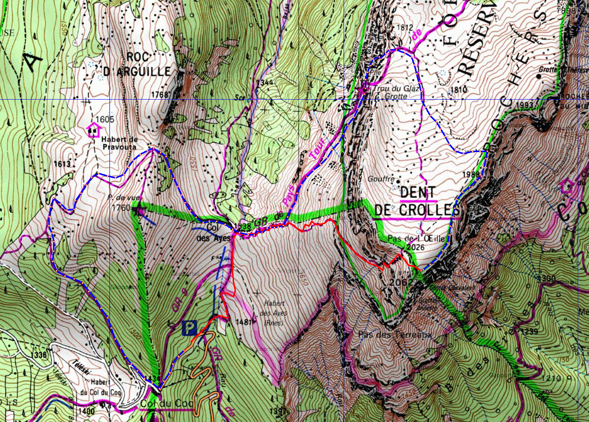
 1 | As usually, the trace of the way up is in red, and the the one of the way down in blue. I forgot to put a waypoint for the picnic place, but it's easy to find: the dot right after the pass marked 1988 on the ridge, 2 dots before we leave the ridge | 1200x860px | 1.1MB

 At first page  Next image  Index page


  20160925-000-DentCrolles-map-trace.jpg - As usually, the trace of the way up is in red, and the the one of the way down in  blue. I  forgot to put a waypoint for the picnic place, but it's  easy to find: the dot right after the pass marked 1988 on the ridge, 2 dots  before  we leave the ridge  
20160925-001-DentCrolles
20160925-005-DentCrolles
20160925-007-DentCrolles
20160925-009-DentCrolles
20160925-010-DentCrolles

Author: SG
Total images: 24 | SG | Help